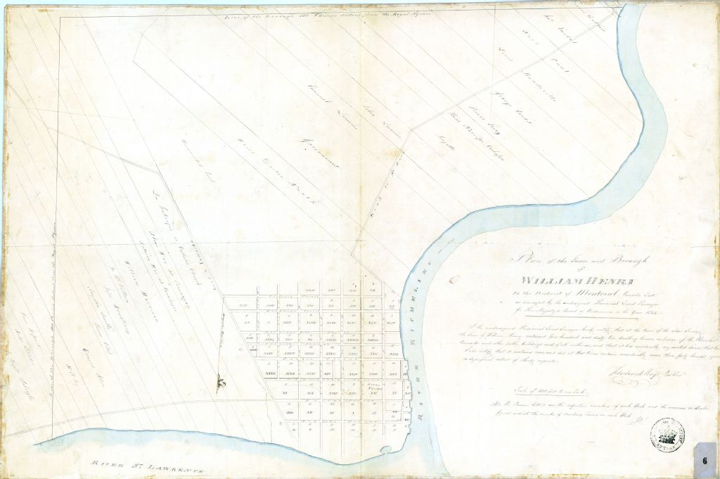
Plan of the town and borough of William Henry in the district of Montreal, Canada East as surveyed by the undersigned Provincial Land Surveyor for her Majesty's Board of ordnance in the year 1844.
Voir les informations
Détails du document
Informations détaillées
- Conditions générales d'utilisation :
-

- Titre :
- Plan of the town and borough of William Henry in the district of Montreal, Canada East as surveyed by the undersigned Provincial Land Surveyor for her Majesty's Board of ordnance in the year 1844.
- Créateur :
- Frederick Wyss (Weiss)
- Date de création :
- 1844-01-01
- Genre spécifique :
-
- Plan du Village de William Henry (Sorel)
-
- Plan du Village de William Henry (Sorel)
- Sujet traité :
- Notice détaillée :
- Collections et fonds :
- Lieu de conservation :
-
Lien :Le lien est la meilleure manière de partager ou de conserver une ressource. Il est basé sur l'ARK (Archival Resource Key), un identifiant pérenne. Seules les suppressions et les nouvelles numérisations pourraient rendre ce lien invalide.
-
Fichier (1)
Ce document ne peut être affiché par le visualiseur. Vous devez le télécharger pour le voir.
Document disponible pour consultation sur les postes informatiques sécurisés dans les édifices de BAnQ. À la Grande Bibliothèque, présentez-vous dans l'espace de la Bibliothèque nationale, au niveau 1.